NewTurbulence forecast
Know how smooth your flight will be.
Flying forecasts turbulence along your exact route, at every altitude, for flights anywhere in the world. Check it before you board, and follow it all the way to landing.
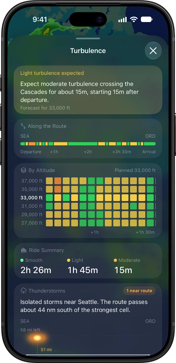
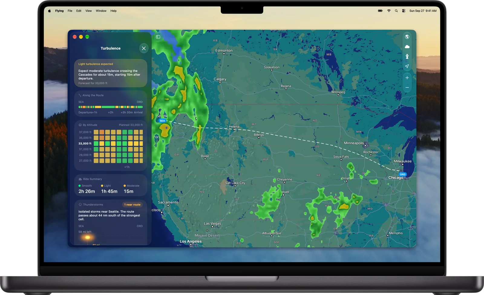
Your whole route at a glance.
Weather radar, turbulence, and storms along your route, all on one map. Check it on iPhone, iPad, or Mac.

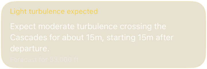
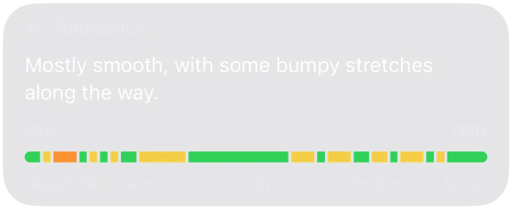
See exactly where it gets bumpy.
Flying shows where along your route turbulence is expected, how strong it should be, when it starts, and how long it lasts.
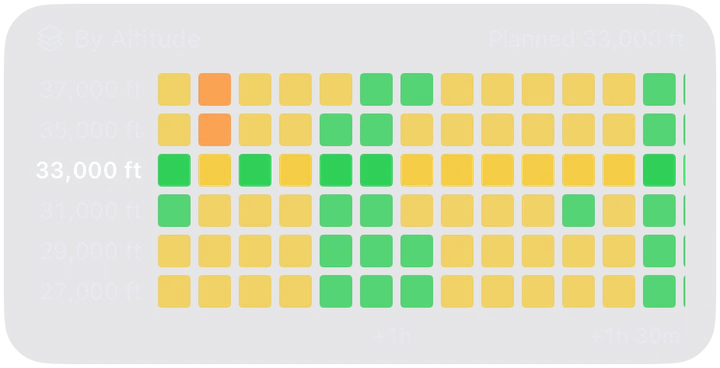
Every altitude, every stretch.
Compare turbulence at the flight levels above and below your cruising altitude, with your planned altitude highlighted. When a nearby level looks smoother, Flying points it out.

Your ride, summed up.
A quick summary tells you how much of the flight should be smooth, and how much might be light or moderate turbulence.

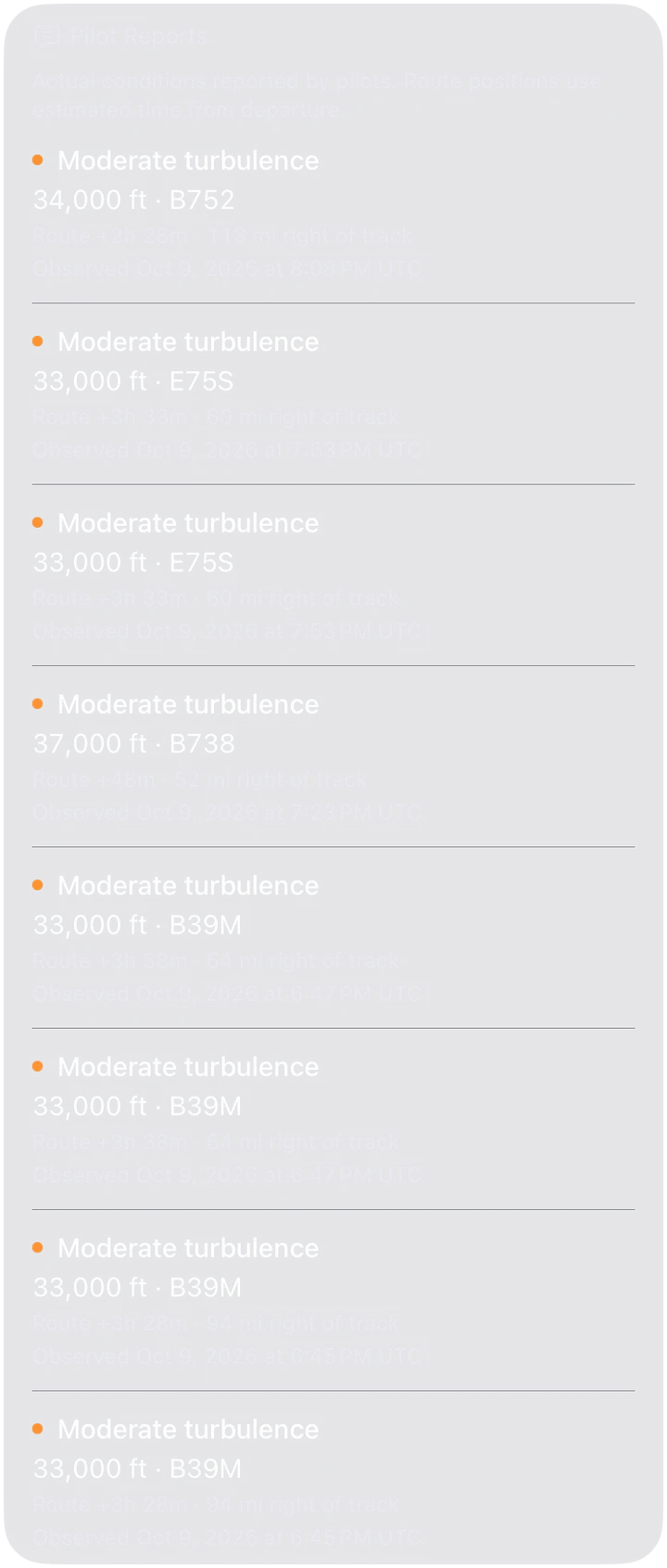
Straight from the cockpit.
Across North America, pilot reports show turbulence that aircraft actually encountered near your route, with the altitude, the type of aircraft, and how far it was from your track. And when pilots nearby report smooth air, Flying tells you that too.
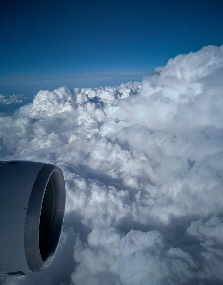
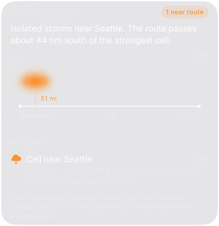
Storms along the way.
Know when thunderstorms are near your route, how far you'll pass from the strongest cells, and which way they're moving.

Built for your flight, not just your route.
Flying uses your flight's filed route and altitude, and the plane assigned to it. Once you're in the air, it follows the aircraft's real position and altitude. And since the same air that feels moderate in a regional jet is a lighter ride in a widebody, the forecast is tuned to the size of your plane.
Honest about the bumps.
Every part of the forecast comes from current forecast models, official advisories, or real reports from pilots, with no rules of thumb filling the gaps. When the data isn't there, Flying tells you instead of guessing.
Ready before you are.
Forecasts are usually ready about a day before departure, for flights anywhere in the world. Forecaster advisories and pilot reports refresh every 10 minutes, and over the US a new forecast run arrives every hour.
Turbulence questions, answered.
How far ahead can I check the turbulence for my flight?
Your flight's turbulence forecast is usually ready about a day before departure. It sharpens as new forecast runs arrive and once the airline files its flight plan, and in the air it keeps updating for the rest of your route until you land.
Does it work for international flights?
Yes. Turbulence forecasts cover flights anywhere in the world, including long-haul and overwater routes. Over North America, forecasts are even more detailed and include pilot reports.
Where does the forecast come from?
Over the US, Flying uses NOAA's Graphical Turbulence Guidance, the same turbulence guidance used in US flight operations, with a new run every hour. Everywhere else, it uses NOAA's global forecast model. On top of that come official advisories from aviation forecasters worldwide, known as SIGMETs, and pilot reports across North America.
What do light, moderate, and severe turbulence mean?
Pilots use standard terms from the FAA's Aeronautical Information Manual. In light turbulence, you might feel a slight strain against your seat belt and unsecured objects may shift a little. In moderate turbulence, you'll feel definite strain against your seat belt, unsecured objects can be dislodged, and walking is difficult. Severe turbulence brings large, abrupt changes in altitude and is rare on airline flights. Behind the scenes, Flying measures turbulence in EDR (eddy dissipation rate), the international standard airlines use, then translates it into these categories for the size of your plane.
Is turbulence dangerous?
Turbulence can be uncomfortable, but airliners are built to handle far more than passengers ever feel. Most turbulence injuries happen to people who aren't buckled in, so the best protection is simple: keep your seat belt fastened whenever you're seated.
How accurate are turbulence forecasts?
Forecasts show where the conditions that cause turbulence are likely, not every individual bump, and some turbulence, like clear-air turbulence, is hard to predict. That's why Flying pairs forecasts with official forecaster advisories worldwide, and pilot reports across North America.
Can I look back at the forecast after I land?
Yes. Flying keeps the forecast your flight actually flew with, including the altitudes you flew at. The part of the route you've already flown never changes after the fact, so it's an honest record of what was known when you flew.
Fly with fewer surprises.
Get turbulence forecasts, flight alerts, and more with Flying on iPhone, iPad, and Mac.
Download on the App Store